Geo and earth observation data: The Space4Sustainability initiative
Conference
65th ISI World Statistics Congress
Format: IPS Abstract - WSC 2025
Keywords: #sdgs, data4sdg, earth-observation
Abstract
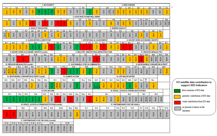
The presentation will examine the critical role of Earth Observation (EO) data in supporting the Sustainable Development Goals (SDGs) through the Space4Sustainability (S4S) initiative at the Centre for Environment and Sustainability, University of Surrey, UK. The SDGs, set by the United Nations, require high-quality and timely data to monitor progress across 231 unique indicators. However, challenges such as data availability, disaggregation by demographic factors, technical capacity for data analysis, and political commitment hinder accurate measurement in many countries, particularly in developing nations. EO data from satellites provides a viable solution to these challenges by enabling the collection of reliable, unbiased information without the need for extensive on-the-ground infrastructure, thus reducing costs and improving data quality. In one of our research projects, we introduced the Maturity Matrix Framework (MMF), a tool developed to evaluate the effectiveness of EO data in populating SDG indicators. The MMF provides a structured approach to assessing EO data’s potential across various premises, such as uncertainty, directness, completeness, non-EO data requirements, practicality, and cost-effectiveness.
The presentation will illustrate the application of the MMF in several case studies, highlighting EO data’s potential in both environmental and socio-economic domains. For instance, one case study explores the use of EO data to estimate overcrowding in Nigerian rural primary schools, addressing SDG 4 (Quality Education). The study combines satellite-derived data with government enrolment records to assess classroom space, revealing that 81.4% of the schools exceed the national overcrowding threshold, a factor that negatively impacts educational outcomes.
Another case study utilises Night-Time Light (NTL) data to map social deprivation in Durango State, Mexico, demonstrating the potential of EO data to support SDG 1 (No Poverty) and SDG 7 (Affordable and Clean Energy) indicators. The research finds a correlation between low NTL radiance and high social deprivation, providing a cost-effective alternative to traditional surveys and enabling more frequent monitoring.
As part of the S4S initiative, we led a project called Space4Nature, which focuses on leveraging EO data to support biodiversity conservation and ecosystem restoration efforts, aligning with SDG 15 (Life on Land). Space4Nature aims to combine Very High-Resolution (VHR) satellite data with local ecological expertise and citizen science to create detailed habitat mapping and quality across Surrey, UK. Space4Nature uses advanced machine learning techniques to automatically identify habitat types such as chalk, modifier, acid grasslands and heathland. This approach enhances the Monitoring, Reporting, and Verification (MRV) of conservation efforts, enabling more effective habitat management, ecological connectivity, and targeted nature recovery strategies. The project exemplifies how EO technology can provide critical insights into biodiversity patterns, help prioritise conservation actions, and support policy development for sustainable land use and ecosystem management.
Figures/Tables
12_Figure-12-2


